Engagement Archive · Battle of the Paracel Islands
Four submarine chasers and minesweepers, totaling 1,700 tons, held their ground in the reef-flat channels of Yongle Atoll against four U.S.-built South Vietnamese warships totaling 6,000 tons, sinking one and damaging three, then recovered three islands the next day -- the People's Navy's first external naval battle (framing varies by account), and the two days when all of the Paracels came under Chinese control.
Engagement Data
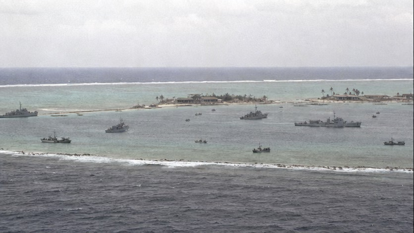
| Item | Content |
|---|---|
| Time | 1974.1.19–20 (the standoff escalated from 1.15) |
| Place | Yongle Atoll, Paracel Islands (the waters around Chenhang, Guangjin, Jinqing, and other islands, and Ganquan, Shanhu, and Jinyin islands) |
| Belongs To | Guarding the Frontiers · Paracel and Spratly Islands (for the larger picture, see the overview) |
| Chinese side | South Sea Fleet submarine chasers 271 and 274, minesweepers 389 and 396 (supporting submarine chasers 281 and 282); island militia and garrison detachments; naval commander Wei Mingsen (deputy commander of Yulin Base, exact post unrecorded) |
| South Vietnam | Escort destroyer *Tran Khanh Du* (HQ-4), patrol ship *Ly Thuong Kiet* (HQ-16), patrol ship *Tran Binh Trong* (HQ-5), gunboat *Nhat Tao* (HQ-10, converted from a minesweeper), and island-landing detachments |
| Result | *Nhat Tao* sank, and three South Vietnamese ships withdrew westward damaged; on 1.20 the Chinese side recovered Ganquan, Shanhu, and Jinyin islands, captured 48 people (figures vary by account), and gained full control of the Paracels |
Belligerents
| Item | Chinese formation | South Vietnamese fleet |
|---|---|---|
| Vessels | 2 submarine chasers + 2 minesweepers (with 2 supporting submarine chasers); the four engaged vessels totaled about 1,700 tons | 4 U.S.-built medium warships, totaling about 6,000 tons (all figures approximate; itemized details unrecorded) |
| Naval guns | Largest 85 mm, mainly 37 mm and 25 mm rapid-fire guns (configuration unrecorded) | Largest 127 mm, with 76 mm guns and others (configuration unrecorded) |
| Island-landing forces | Militia and garrison detachments (numbers unrecorded), carried by fishing trawlers and motorized junks | Marine and special island-landing detachments (numbers unrecorded) |
| Support base | About 180 nautical miles from Yulin Base, at the edge of shore-based fighter operating radius | About 200 nautical miles from Da Nang (approximate), equipped with U.S. aid but no longer backed by U.S. forces |
| Weaknesses | No large-caliber naval guns; no naval supply ships | Large ships with deep drafts were wary of the reef flats; command chain and morale were weak |
Terrain and Conditions
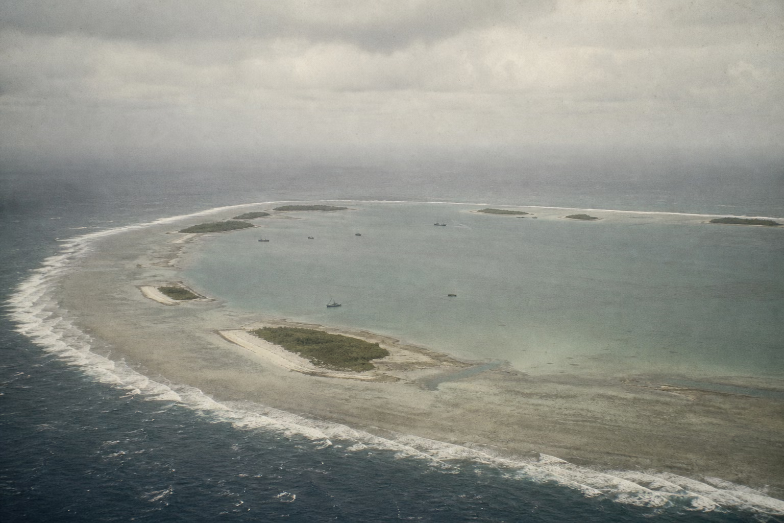
(For the 1974 larger picture -- Sino-U.S. rapprochement, U.S. withdrawal from Vietnam, and oil exploration in the South China Sea -- see *Paracel and Spratly Islands: Overview*. This article deals only with the Paracels.)
The Paracels are divided into two groups. To the east are the Xuande Islands, with Yongxing Island as the main island, where the Chinese side had maintained a presence since the 1950s. To the west are the Yongle Islands, where an atoll encloses a shallow-water fishing ground and the islands face one another across the water: Shanhu Island held South Vietnamese troops from 1956 onward, while Ganquan, Jinyin, Chenhang, Guangjin, Jinqing, and other islands had no permanent garrison, only Tanmen fishermen moving through during the fishing season and militia who had just landed in mid-January. In January the northeast monsoon blows over the Paracels, the seas outside are rough, and small craft of several hundred tons find calm water only after entering the atoll. The atoll was both fishing ground and anchorage; whoever controlled the reef-flat channels controlled Yongle.
Why It Was Fought
After the northern land frontier cooled, the next border-defense war came from the sea (for the route to this point, see *Paracel and Spratly Islands: Overview*). In January 1973, the Paris Peace Accords were signed, U.S. forces withdrew from Vietnam, and the Seventh Fleet pulled back. Saigon inherited large numbers of vessels transferred by the U.S. military, but not the war the Americans had left behind. For the Nguyen Van Thieu regime, there was a ready-made calculation between this enlarged navy in its hands and the shaking state beneath its feet: the larger the faits accomplis at sea, the more capital it would have in the future, whether for war or peace -- all the more because survey reports were saying that the seabed might contain oil.
In September, South Vietnam announced that more than ten islands in the Spratlys had been placed under Phuoc Tuy Province. On January 11, 1974, China's Ministry of Foreign Affairs issued a statement reaffirming sovereignty; Saigon's answer was to send warships into the Paracels. Beginning on January 15, *Ly Thuong Kiet* entered Yongle Atoll, drove off Chinese fishing vessels 402 and 407 while they were working, and shelled Ganquan Island, which was flying the Chinese national flag. On the 17th and 18th, South Vietnamese forces successively landed on and occupied Jinyin and Ganquan islands, while four ships pressed toward the Chinese side inside and outside the atoll. They had held Shanhu Island in Yongle for eighteen years; this time they wanted the entire atoll.
Beijing's response was set along two lines: diplomatic protests would still be issued, while at sea it sent the only small craft available -- two submarine chasers to protect the fishing boats, followed by two minesweepers. Militia moved overnight onto Chenhang, Guangjin, and Jinqing islands, taking positions first on the islands that had not yet been occupied. In both sides' calculations, the same variable weighed heavily: the United States. Saigon assumed that the Seventh Fleet stood behind it in the end; Beijing judged that, after Sino-U.S. rapprochement, Washington would not enter the field for Saigon. Before and after the fighting began, U.S. ships watched from the outer waters and did not advance (deployment details unverified) -- the answer to that variable had in fact already been opened.
At dawn on January 19, South Vietnamese landing teams waded ashore and forced landings on Chenhang and Guangjin, confronted and exchanged fire with the island militia on the reef flats, and were repelled (sequence and casualty details unrecorded). Around 10 a.m., after days of standoff, the two fleets opened fire in the atoll channels. Each side's battle reports give a different account of who fired first.
In fact, Saigon had been given a step on which to stop: Chinese vessels had arrived, and both the balance of forces and the U.S. attitude were already visible. But for a regime relying on "no retreat" to sustain morale, withdrawing from territory it had declared its own was harder than fighting a battle. The fleet did not turn back.
Course of the Engagement
| Phase | Time | Key Points |
|---|---|---|
| Driving off fishing vessels and occupying islands | 1.15–18 | *Ly Thuong Kiet* drove off fishing vessels 402 and 407 and shelled the national flag on Ganquan Island; South Vietnam landed on and occupied Jinyin and Ganquan islands; Chinese 271 and 274 arrived to protect the fishing boats, and militia entered Chenhang, Guangjin, and Jinqing; follow-on vessels from both sides arrived in succession, and eight ships faced off inside and outside the atoll |
| Reef-flat clash | Morning, 1.19 | South Vietnamese landing teams forced landings on Chenhang and Guangjin, faced off and exchanged fire with militia, and were repelled (casualty details unrecorded) |
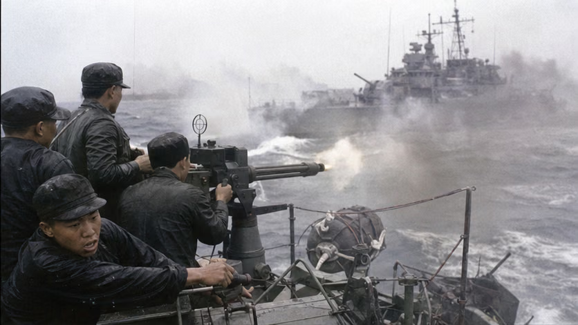
| Fleet engagement | Morning, 1.19 | From about 10:20 (time unverified), four-on-four close combat: 271 and 274 tangled with *Tran Khanh Du* and *Tran Binh Trong*, while 389 and 396 faced *Ly Thuong Kiet* and *Nhat Tao*; 274's bridge was hit, and political commissar Feng Songbai and others were killed; 389, heavily damaged, saved itself by beaching on the reef flat near Chenhang; *Nhat Tao* was disabled, and the three South Vietnamese ships withdrew westward damaged |
| Finishing fire | Afternoon, 1.19 | 281 and 282 arrived from the waters around Yongxing Island and sank the disabled *Nhat Tao* (after about 14:00; time unverified) |
| Recovering the three islands | 1.20 | Under naval-gun cover, garrison troops and militia landed in waves and recovered Ganquan, Shanhu, and Jinyin islands within one day, capturing 48 South Vietnamese officers and soldiers (one account says 49, including 1 U.S. liaison officer; unverified) |
| Epilogue | From 1.21 | Three frigates from the East Sea Fleet moved south to reinforce and passed through the Taiwan Strait (ship names unverified; the accounts that this was "the first organized formation to pass through the front of the strait" and that "the Taiwan side did not obstruct it" are widely circulated but disputed at the level of historical evidence; see the disputes section); the U.S. Seventh Fleet never intervened |
Casualties and Losses
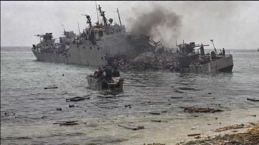
- Chinese side: 18 killed and 67 wounded (Chinese figures); ship 389 was heavily damaged (later towed back and repaired), and 274 and other ships were damaged; the 18 martyrs were buried on Chenhang Island.
- South Vietnam: *Nhat Tao* sank (captain Wei Wenta was killed; translated name unverified), and three ships were damaged; Vietnamese figures give 74 killed (unverified) and 48 captured (figures vary by account); Chinese battle reports also include an account of more than 100 enemy killed and wounded (figures vary by account).
- Fishing vessels 402 and 407 were driven off and damaged by ramming (details unrecorded); no civilian residential area was drawn in.
Aftermath
- With Yongle taken, the Paracels were entirely under Chinese control; garrisons and construction then moved onto the islands, and a martyrs' cemetery was built on Chenhang Island.
- South Vietnam threatened a counterattack and assembled ships but did not sail (unverified); captured officers and soldiers were repatriated through Red Cross channels in February (route and date vary by account).
- North Vietnam is not seen to have made a public protest over this battle, and its official response was low-key (record unverified). Fifteen months later, before Saigon fell, the North Vietnamese navy moved first to receive South Vietnam's islands and reefs in the Spratlys: the gap that closed in the Paracels became a position Hanoi first occupied in the Spratlys. The next battle would come fourteen years later at Chigua Reef.
- This battle exposed the shortage of large vessels in the South China Sea direction and became a catalyst for the later expansion of the navy there (construction details unrecorded).
Accounts of Those Present
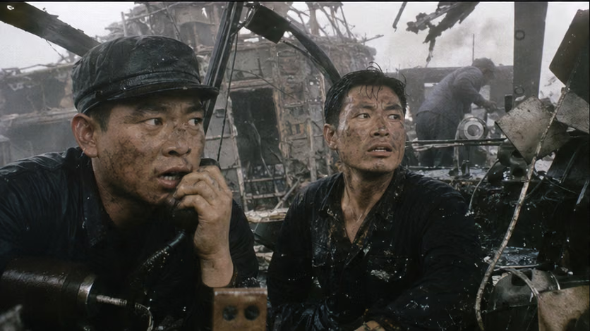
- Bridge: 274's bridge took a direct hit, and political commissar Feng Songbai and deputy gunnery officer Zhou Xitong were killed (posts unrecorded). In close combat by small craft, officers and sailors stood on the same deck under shellfire.
- Plugging the leak: Guo Yudong, an electromechanical sailor on ship 389, kept plugging leaks in the flooding engine room until the end. The ship survived by beaching; he did not come out (details unverified). He was posthumously credited with first-class merit.
- Fishing boats used as warships: Fishing vessels 402 and 407 held the confrontation line for four days and had their upper structures damaged by *Tran Khanh Du* ramming them (details unrecorded). They were also the vessels that carried militia and transported the wounded. Entry into and exit from the reef-flat channels depended on Tanmen fishermen who had worked there for years as pilots (record unverified).
- How close it was: With small tonnage and small guns, the Chinese method was to close in and strike hard -- close enough for antiaircraft machine guns to fire flat, and for sailors, according to a widely circulated account, to throw hand grenades onto enemy decks (widely circulated; details unverified).
- The opposing captain: The captain of *Nhat Tao*, Wei Wenta, went down with his ship. He later became the central figure in the memorial system across the line. Desperation and the honors that follow it belong to more than one side.
The Ground
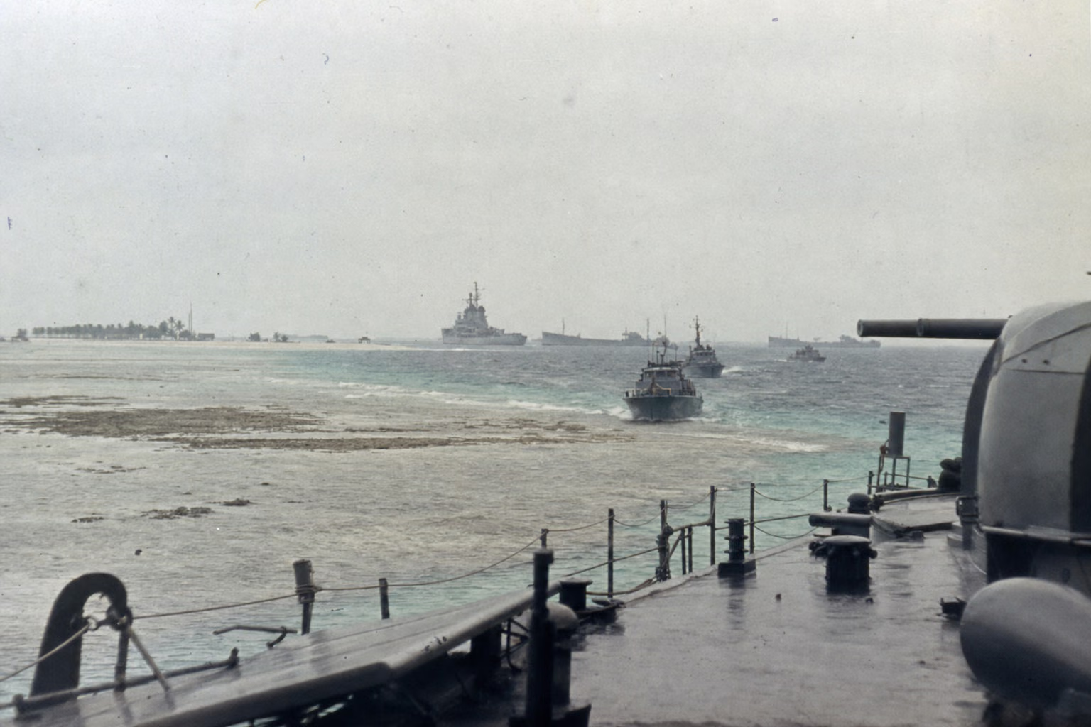
- Yongle Atoll is a shallow-water field enclosed by a ring of islands and reefs: the color boundary of the reef flat marked the boundary of the battlefield. Large ships, with deep drafts, did not dare press onto the reef flats, and half their tonnage advantage was canceled by terrain. Small craft maneuvered close to the reefs, trading terrain for firepower.
- Two groups of engagements unfolded at the same time, several nautical miles apart, near enough to hear one another's gunfire but too far to see the battle clearly -- a naval battle cut in two by the atoll.
- The space on landing day: wading ashore, beach landings, coconut groves, old barracks; islands facing islands, and naval shells coming over the top from the horizon.
- Scale of distance: about 180 nautical miles from the mainland base, with shore-based fighters' time over the target measured in minutes (range details unverified) -- support was measured in hours; life and death in minutes.
How Each Side Records It
- Chinese side: prominent commemoration -- the formulation "the People's Navy's first victory in an external naval battle" (source unverified); the 1976 film *Storm over the South China Sea*; annual memorial ceremonies at the martyrs' cemetery on Chenhang Island, and later passing naval vessels sounding their horns in tribute in the waters off Chenhang (ritual development unverified).
- South Vietnam (at the time): Saigon battle reports claimed heavy damage to the Chinese fleet, and the figures for ships sunk do not match the Chinese battle reports -- the two sets of reports stand side by side as disputed. Domestic propaganda framed it as a "naval battle hero" narrative, and Wei Wenta received posthumous promotion (unverified).
- Vietnam (after unification): January 19 is marked as the day of commemoration for "Hoang Sa," and Wei Wenta and other South Vietnamese dead are posthumously honored -- a unified regime commemorating soldiers from an old enemy camp is a rare turn in Vietnamese memory history.
- North Vietnam (at the time): silence -- it was relying heavily on Chinese aid, and the 1958 note was already on record (see the overview); its public response was low-key (record unverified).
- Taiwan side: Taipei issued a statement reaffirming sovereignty over the South China Sea islands (wording unverified); versions of the "strait passage" legend exist on both sides of the strait (see the disputes section).
- U.S. side: its position of non-intervention was clear, and declassified cables show that the Seventh Fleet was ordered to avoid involvement (source unverified); the captured U.S. national was quietly released.
Disputes and Sensitivities
- Who fired first: the Chinese account says the South Vietnamese fleet opened fire first; the Vietnamese account says the opposite.
- Figures and statistical bases: casualty figures, prisoner counts (48/49), and the identity of the U.S. liaison officer all have multiple accounts.
- The Taiwan Strait account: the story that an East Sea Fleet formation passed through the strait, that the Taiwan side did not obstruct it, and even that it "turned on the navigation lights" is extremely widely circulated, but disputed at the level of historical evidence. The circulation layer and the evidentiary layer are marked separately, unverified.
- North Vietnam's note and silence: a central citation point in today's South China Sea arguments; the facts at the time and present-day disputes belong to different levels.
- South Vietnam's decision-making motives: interpretations such as "diverting attention from domestic politics" belong to later explanation.
Sources and Open Questions
Sources: *The Contemporary Chinese Navy* and other naval war histories; memoirs by participating commanders, officers, and sailors (Wei Mingsen and others; itemized titles unverified); postwar memoirs by South Vietnamese participating officers (He Wen'e and others; translated names unverified); U.S. declassified diplomatic cables; Taiwan-side archives.
Open questions: itemized details of both sides' gun positions and tonnage; times of the engagement and sinking; casualty details from the reef-flat clash; number of prisoners and identity of the U.S. national; repatriation route and date; ship names and historical evidence for the strait transit; posts held by Feng Songbai and Zhou Xitong; details of Guo Yudong's deed; details of the fishing vessels' damage; source for the "first external naval battle" formulation; North Vietnam's contemporary reaction in the documentary record; translation of Wei Wenta's name and posthumous promotion.
All images on this site are AI-generated depictions. They are not historical photographs, not primary sources, and do not depict any real individual.