Engagement Archive · Battles of Laoshan and Zheyinshan (rotating campaigns of the Two Mountains)
On April 28 and 30, 1984, the 14th Army recovered Laoshan and the Eleventh Army recovered Zheyinshan; on July 12, a Vietnamese division-scale counterattack was broken up under interdiction by artillery groups. For the next 5 years, troops from the major military regions took turns going up the mountains -- the "rotating campaigns" were both defense of the soil and the only practical battlefield classroom for an army then undergoing reform; only when the rotating campaigns wound down in 1989 did the sound of artillery gradually fade in the early 1990s.
Engagement Data
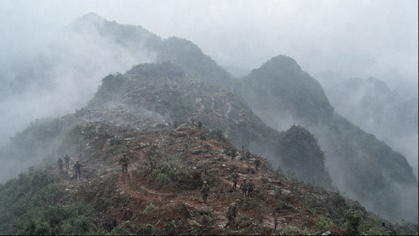
| Item | Content |
|---|---|
| Time | 1984.4.28 recovery of Laoshan, 4.30 recovery of Zheyinshan; 1984.7.12 Vietnamese division-scale counterattack broken up; the rotating campaigns wound down in 1989, with artillery fire gradually fading around 1990 |
| Place | The Laoshan area west of Chuantou / Tianbao Port of Entry in Malipo County, Yunnan (including Height 662.6, the Nala direction, and Balihé East Mountain), and the Zheyinshan area in the Yangwan direction of Malipo County (administrative wording unverified); the Vietnamese side called the opposite front the Vi Xuyen direction in Ha Tuyen Province (today Ha Giang Province) |
| Belongs to | Sino-Vietnamese War · phase of the rotating campaigns of the Two Mountains (for the larger situation, see *Sino-Vietnamese War · Overview*) |
| Chinese Side | Recovery phase: 40th Division, 14th Army, Kunming Military Region (Laoshan); 31st Division, Eleventh Army (Zheyinshan); and military-region artillery groups. Rotating-campaign sequence (opening and closing months unverified): First Army (Nanjing Military Region) -> 67th Army (Jinan Military Region) -> 47th Group Army (Lanzhou Military Region) -> 27th Group Army (Beijing Military Region) -> 13th Group Army (Chengdu Military Region), with reconnaissance battalions from the major military regions also entering the war in batches |
| Vietnamese Side | Opposing units of the Second Military Region: 313th Division and other defenders; the 7.12 counterattack concentrated elements of the 356th, 316th, and 312th Divisions, about 6 regiments in all (organization details unrecorded); afterward, divisions rotated opposite the front for the long term |
| Result | The Chinese side seized and held the main positions on the Two Mountains, and the Vietnamese army did not retake them in any of its counterattacks; in 1989 the rotating-campaign troops withdrew and border-defense units took over |
Belligerents
(Point seizure and positional warfare viewed together; attack and defense changed places in different phases, so the table lists camps rather than attacker and defender.)
| Item | Chinese Side | Vietnamese Side |
|---|---|---|
| Troops | Division scale in the recovery operations; during the rotating-campaign period, one army-level unit per rotation, with cumulative participation over 5 years counted in the hundreds of thousands (total unrecorded) | Year-round division-level defense opposite the front plus depth echelons; the 7.12 counterattack was about reinforced-division scale |
| Firepower | Artillery was the main actor: army- and division-level artillery groups and rocket artillery, later joined by counter-battery radar and fire-adjustment means (equipment details unrecorded) -- the victory on 7.12 was first of all an artillery victory | Artillery in depth kept up duels; fortifications relied on karst caves |
| Fortifications | Cat-ear caves, trenches, troop caves -- stone mountains could not be dug deeply, so individual soldiers lived in holes | The same mountains, the same caves -- soldiers on both sides lived in mirror-image works |
| Supply | Vehicle roads ended at the foot of the mountains, and the last several kilometers depended on "military labor" carrying loads by human backs -- water, ammunition, and canned food on the front line all moved by manpower (unverified) | Pack animals and manpower on reverse slopes, in much the same condition |
Terrain and Conditions
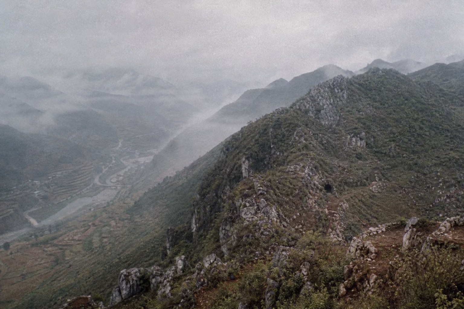
(For the larger situation, see *Sino-Vietnamese War · Overview*. The time point in 1984: Sino-British negotiations and the beginning of urban reform -- the border war was fought in an era when the whole country was turning toward the economy, and that contrast is the undertone for understanding the narrative of the "rotating campaigns.")
Laoshan stands astride the main ridge of the China-Vietnam boundary. In the Chinese basis, its main peak is 1,422.2 meters above sea level (elevation unverified); the Vietnamese side calls it Height 1509 -- the same mountain, 2 names and 2 elevations, with the naming itself already a position (surveying differences unverified). It commands the Panlong River valley, the Chuantou-Tianbao Port of Entry road, and the direction of Malipo county seat. Zheyinshan lies to its east and commands the valley in the Yangwan direction. After the 1979 withdrawal, the Two Mountains were occupied and fortified by Vietnamese troops (timing unverified), and shelling opposite the front continued: Malipo border residents were killed or wounded, fields were abandoned, and the port of entry was sealed shut (local-gazetteer figure disputed)※. Subtropical stone mountains, many foggy days throughout the year, and a rainy season lasting several months; karst caves were both natural fortifications and channels for infiltration detachments on both sides.
Why It Was Fought
After Fakashan and Koulinshan were recovered, the confrontation line along the border stabilized for a time -- but only in the lower places. The higher mountains were still in Vietnamese hands: Laoshan sat astride the main boundary ridge, and its main peak of more than 1,400 meters (elevation unverified) put Chuantou Port of Entry, the Panlong River valley, and half of Malipo County into its observation glass; Zheyinshan, to the east, did the same thing. In 1981, what had to be taken were points. In 1984, what had to be taken were mountains.
Why the 3-year interval -- the army used these years to digest the problems exposed in 1979: pre-battle training, artillery reconnaissance, and exercises in combined-arms mountain operations became normalized on the southwest border (details unrecorded). Why that spring -- the Vietnamese army had just passed through its dry-season offensive on the Cambodian battlefield, and Hanoi's main forces and attention were pressed into the southwest; opposite Yunnan, records of Vietnamese shelling injuring border residents had continued to accumulate over the preceding year (incidents and figures disputed); any later, and the rainy season would arrive.
The Chinese calculation was still point-seizure in form: seize the heights straddling the line and push back the observation posts, without developing into the depth -- the same logic as in 1981, raised to division scale. The Vietnamese calculation truly unfolded only after the mountains were lost: the Laoshan front was ground Hanoi had to contest, and the Second Military Region organized a division-scale counterattack within 2 months under the code name MB-84 (plan name and organization details unrecorded), intending to retake the area in one stroke during the rainy season. The misjudgment lay here as well: the counterattack assumed that assembly and movement could be hidden from the other side, while Chinese artillery groups had already completed firing-data settings before dawn on July 12 (accounts differ on the channels and basis by which warning signs were learned before the battle).
Beginning on April 2, Kunming Military Region artillery began nearly a month of artillery preparation against the positions opposite the Two Mountains (opening and closing dates unverified). Before dawn on April 28, the 40th Division attacked Laoshan. 2 days later, the 31st Division attacked Zheyinshan.
Course of the Engagement
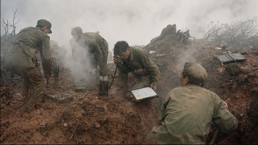
| Phase | Time | Key Points |
|---|---|---|
| Artillery preparation | 4.2-4.27 | Nearly a month of shelling against positions opposite the Two Mountains and in their depth (opening and closing dates unverified) |
| Recovery of Laoshan | 4.28 | The 40th Division attacked before dawn, took the main peak in several hours, and continued to take the Height 662.6 line; on 5.15 it took Balihe East Mountain (unit details unrecorded) |
| Recovery of Zheyinshan | 4.30 | The 31st Division took the heights of Zheyinshan (details unrecorded) |
| Vietnamese counterattacks | 6.11, 7.12 | The 6.11 regiment-scale counterattack was repulsed (unverified); before dawn on 7.12, the division-scale counterattack under the MB-84 plan struck along multiple routes toward the Nala-Songmaoling direction -- Chinese artillery groups carried out interdiction, suppression, and rapid fire; by that evening, the Vietnamese troops broke and retreated. The Chinese basis claimed more than 3,000 enemy killed; the Vietnamese basis said more than 600 men of the 356th Division died that day, and marks the day as Vi Xuyen's "day of mourning for battle" -- the 2 sets of figures have different statistical bases and are listed side by side (both unverified) |
| Rotating-campaign seesaw | 1984.12-1989 | The First Army took over the defense (1984.12, unverified), and on 1985.1.15 repulsed another major counterattack (unverified); during the 67th Army's period, on 1985.5.31 Vietnamese troops seized part of the outposts on Height 211, after which the position was fought over repeatedly at heavy cost (course and figures disputed); the 47th Group Army launched the "Blue Sword-B" attack in 1986.10, and the 27th Group Army launched the "Black Panther" attack in 1987.1 (target heights and dates vary by account); after 1988, offensive operations gradually stopped, leaving an artillery-duel and sniper-fire confrontation |
| Wind-down | 1989-90 | Vietnam withdrew from Cambodia and China-Vietnam relations eased; rotating-campaign troops withdrew and Yunnan Provincial Military District units took over the defense (sequence unverified); sporadic shelling continued to around 1990 (time of the last battle unverified) |
Casualties and Losses
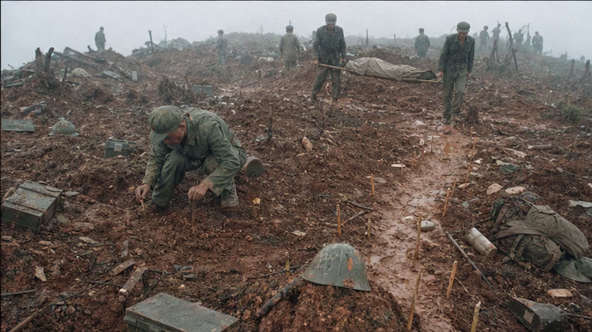
- Chinese side: no authoritative public total exists for casualties over the 5 years of rotating campaigns (unverified); more than 900 martyrs are buried in Malipo Martyrs' Cemetery (figure disputed), with other cemeteries including Pingbian as well -- cemetery figures are the firmest lower bound now available.
- Vietnamese side: official figures were not published for a long period; after 2014, the commemorative basis in Vietnamese media said more than 4,000 died in the Vi Xuyen direction, with others missing or still unrecovered (unverified) -- Vietnamese veterans' organizations continue search-and-recovery work to this day.
- 7.12 single day: Chinese basis: more than 3,000 enemy killed / Vietnamese basis: more than 600 deaths in the 356th Division -- the statistical bases (whether wounded are included, whether the whole line is included, whether deaths after evacuation are included) are all unclear and listed side by side.
- ※ Border residents: on the Malipo side, deaths, injuries, and mine-related disabilities from shelling continued for decades after the war (figure disputed); on the Vietnamese side, border residents in Ha Tuyen likewise bore long-term shelling and mine danger (Vietnamese bases vary by account).
- Land mines: mines laid in the Two Mountains area numbered in the millions (bases vary by account), followed by multiple rounds of postwar demining (opening and closing dates unverified) -- the longest bill left by this war.
Aftermath
- The wind-down of the rotating campaigns was not a ceasefire agreement, but the natural thinning of artillery fire -- Vietnam's 1989 withdrawal from Cambodia removed the last rationale for the war, and after normalization in 1991 the border turned to delimitation and the reopening of markets (for the wind-down of the entire war, see the overview).
- The rotating campaigns mattered for military reform: over 5 years, the major military regions took turns using real combat to test new organizations, new equipment, and new methods (combined arms, artillery reconnaissance, electronic countermeasures, medical support -- details unrecorded); they also had the character of training troops, something military documents do not avoid saying -- the ethical tension in "using war to train troops" is treated in the disputes section.
- A generation of military culture grew out of the Two Mountains: *Blood-Dyed Glory*, *The Moon on the Fifteenth* (the songs' relationship to the fighting unverified), "Long Live Understanding," and cat-ear-cave literature -- in China's collective memory of the 1980s, the Two Mountains were what the word "front line" referred to.
- Laoshan main peak and the Zheyinshan positions later became permanent border-defense posts; Malipo cemetery became a place for civilian grave-sweeping and veterans' reunions.
Accounts of Those Present
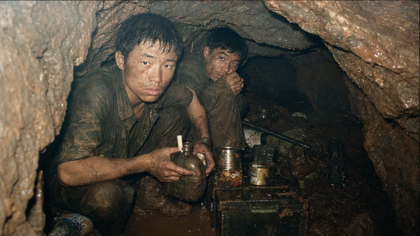
- Cat-ear caves: individual holes in cracks in the rock, lower than waist height, waterlogged in the rainy season; skin disease and "crotch rot" were common illnesses reported publicly. Everything in the caves -- water, canned food, ammunition, candles -- was carried up by "military labor" during intervals between shelling (many public recollections, details unrecorded).
- Zhang Daquan: deputy company commander of the 118th Regiment, 40th Division (position details unrecorded), killed on April 28 after going up Laoshan main peak 3 times; posthumously awarded the title Combat Hero, with a statue on the main peak (details of deeds unverified).
- Li Haixin and Height 142: on July 12, 15 men held the point on Height 142. Li Haixin (position details unrecorded) was killed, and the height was later named after him -- 15 people against an organized assault for an entire day (details unrecorded).
- "Long Live Understanding": front-line speaking tours in the later rotating-campaign period made these 4 characters popular nationwide (one account traces it to touring lectures by the front-line speaker Cai Chaodong around 1985; source unverified) -- the estrangement between front and rear, the gap between sacrifice and the era of marketization, are all in that cry.
- *Blood-Dyed Glory*: at the 1987 Spring Festival Gala, the disabled front-line soldier Xu Liang sang from a wheelchair (year and details unverified) -- the specific night when the Two Mountains entered national memory.
- The caves opposite: Vietnamese soldiers lived in the same stone caves and carried the same water -- Vietnamese veterans' recollections and Chinese recollections are perfectly symmetrical on the word "hardship" (Vietnamese recollection sources unverified); on Vietnamese tombstones in Vi Xuyen, the most common ages are 18 or 19 (Vietnamese media commemorative reports, unverified).
The Ground
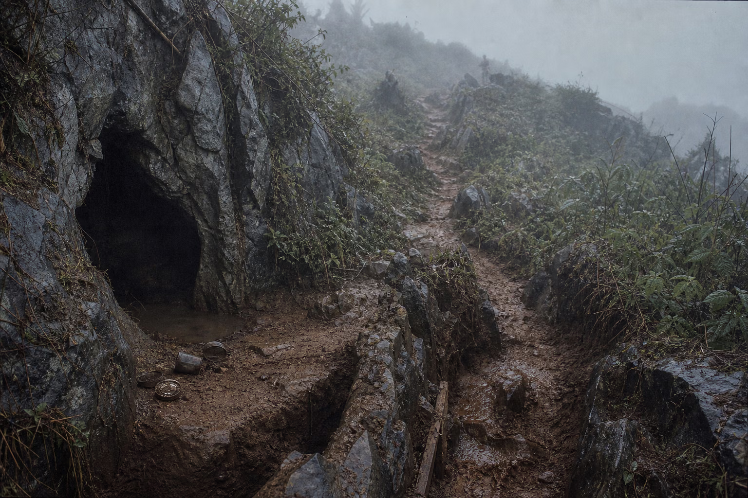
- The two-sidedness of a ridge astride the line: the same ridge, with trenches on the 2 sides separated by several dozen to more than 100 meters (unverified), facing each other for years within throwing range.
- The Nala gap: a lowland salient, with positions interlocked like teeth -- an extreme compressed space in which "the forward edge of the position is the national boundary."
- Fog and rain: fog was frequent year-round, and visibility decided windows for attack; the heavy fog before dawn on 7.12 both covered the Vietnamese approach and trapped the moving formations inside the artillery interdiction fire pocket (battlefield weather records unverified).
- Vertical layering: main-peak observation post - reverse-slope troop caves - valley artillery positions - mountain-foot military-labor roads; a single mountain was a cross-section of a war machine.
- Cat-ear caves: survival space at the scale of one soldier -- darkness, standing water, centipedes, canned-food tins; the bodily feeling of "holding" a position became concrete here.
- Minefields: mixed minefields on the million-mine scale (bases vary by account) and serpentine paths -- for decades after the war, they continued to rewrite what parts of this space could be used.
How Each Side Records It
- Chinese side: the 1980s narrative of "the new generation's most lovable people" ran hot -- reportage, songs, and hero-model lecture tours. From the 1990s, with normalization, it shifted into a lower register, and the Two Mountains faded from textbooks and screens. After the 2000s, veterans' memories resurfaced through the internet -- revisiting Laoshan, searching for comrades' graves, supporting the parents of those who died, and other civilian actions (individual cases unverified) became the main form of commemoration. Laoshan main peak is now a border-defense post and education site (current status recorded only as fact).
- Vietnamese side: Vi Xuyen is the Vietnamese place-name summary for this stretch of fighting. After normalization it was silent for a long period, and after 2014 official and media commemoration clearly warmed -- expansion of Vi Xuyen Martyrs' Cemetery, public ceremonies on July 12 as the "day of mourning for battle," and leaders visiting the cemetery to pay respects (years unverified). The Vietnamese narrative says it held Height 1509 and other heights and frustrated Chinese "salami-slicing" -- a mirror image of the Chinese narrative of "recovering Laoshan," listed here side by side.
- The mirror of names: the Chinese side says "Laoshan, Zheyinshan"; the Vietnamese side refers to the heights by elevation numbers (1509 and others, correspondences unverified) -- 2 naming systems, 2 entrances into memory.
- Settlement of belonging: the 1999 land-boundary treaty and the subsequent boundary survey determined the boundary alignment in the Two Mountains area; various online claims of "cession" coexist with official boundary-survey explanations (relevant literature unverified).
Disputes and Sensitivities
- The ethical tension in "rotating campaigns as troop training": the dual character of defending the soil and training troops is stated plainly in military documents; claims about "using the opponent to train troops" exist in both sides' narratives (corresponding Vietnamese wording unverified).
- Figures for 7.12 and successive battles: Chinese and Vietnamese bases differ by several times, and none of the statistical bases is clear.
- Loss of Height 211: defeat and the cost of retaking it coexist; disputes over honor and blame among the relevant units remain sensitive among veterans to this day.
- Boundary delimitation and rumors of "cession": the treaty and boundary survey are factual nodes; present-day claims and rebuttal debates belong to another layer.
- Disabled veterans' circumstances: sequelae from the cat-ear caves, disability pensions, and the generational experience of the gap between "front line" and "market" remain matters of individual cases (unverified).
- ※ Harm to border residents on both sides from shelling and mines is not compared in size.
Sources and Open Questions
Known main sources:
- War histories and summaries of the 14th Army, Eleventh Army, and the various rotating-campaign forces (internal, holdings retained but unverified)
- Veterans' recollections and oral-history compilations from the Laoshan rotating campaigns (many privately printed volumes and online collections, sifting unverified)
- *Malipo County Gazetteer*; inscription lists at Malipo Martyrs' Cemetery
- Xiaoming Zhang, *Deng Xiaoping's Long War* (chapters on 1984-91)
- Vietnamese side: Ha Giang provincial gazetteers, Vi Xuyen commemorative literature, and Vietnamese media reports after 2014 (bibliography unverified)
- Period texts: *Blood-Dyed Glory*, the "Long Live Understanding" speaking tours, and cat-ear-cave literature (as materials for memory history)
Open questions: full table of opening and closing months for each rotating-campaign force; 7.12 figures and statistical bases for both sides; main-peak elevation and correspondence with Vietnamese names; MB-84 organization; scale of the 6.11 counterattack; course of the Height 211 fighting; details of the Blue Sword-B / Black Panther operations; burial counts at the Malipo and Vi Xuyen cemeteries; source of "Long Live Understanding"; Zhang Daquan's and Li Haixin's positions and details of deeds; year when Xu Liang sang; mine-laying and demining figures; time of the last battle; time when Vietnamese troops occupied the Two Mountains; border-resident casualty and mine-harm figures.
All images on this site are AI-generated depictions. They are not historical photographs, not primary sources, and do not depict any real individual.