Engagement Archive · Battles of Kejielang and Tawang
The first battle of the counterattack lasted only one day: in the Kejielang River valley, the Indian Seventh Brigade, strung out in a single line along the river, collapsed under a dawn offensive; two days later, Brigadier Dalvi was captured in the mountain woods, and five days later Chinese troops entered the empty town of Tawang without firing a shot.
Engagement Data
| Item | Content |
|---|---|
| Time | 1962.10.20 – 10.25 (main fighting at Kejielang on 10.20; entry into Tawang on 10.24–25) |
| Place | Western end of the eastern sector of the Sino-Indian border: the Kejielang River valley (south foot of Thag La Ridge), the front facing Bangshankou, and Tawang (the first major town south of the McMahon Line) |
| Belongs to | Sino-Indian War · main direction in the eastern sector, first phase |
| Belligerents | Chinese border defense forces: forward command of the Tibet Military Region (Zhang Guohua), with the Zangzi 419 Unit (commander Chai Hongquan, political commissar Yin Fatang; commanding the 154th, 155th, and 157th Regiments) as the main force, supported by elements including the Eleventh Division and Shannan Military Subdistrict troops (order of battle details unrecorded) / Indian Army: Seventh Infantry Brigade (Brigadier John Dalvi, under the Fourth Division); the Tawang area also had brigade-level command organs and attached troops (unverified) |
| Result | The Seventh Brigade was destroyed and Dalvi was captured; Indian forces abandoned Tawang and withdrew toward Xishankou; after entering Tawang, the Chinese side stopped its pursuit, and on 10.24 the Chinese government put forward three proposals |
Belligerents
| Item | Chinese border defense forces | Indian Army |
|---|---|---|
| Strength | About ten thousand troops concentrated in the theater, forming a several-fold advantage over the Seventh Brigade (figures vary by statistical basis) | About 3,000 men of the Seventh Brigade deployed in a single line along the river; the garrison troops in the Tawang area counted separately (unverified) |
| Firepower | Mountain guns, recoilless guns, and 82 mm mortars in close support: artillery pieces were broken down and carried by men and pack animals onto the positions for close-range direct fire (unverified) | Brigade support weapons; ammunition stored by airdrop allotments, with few heavy weapons |
| Situation | Looking down from above: Thag La Ridge was in Chinese hands, giving a full view of the Indian deployment in the river valley | A line with its back to the water: positions stretched in a single line across a 15-kilometer front on the south bank of the Kejielang River, with insufficient depth and supply dependent on airdrop (airdrop point locations unverified) |
| Winter readiness | Plateau troops were permanently stationed and acclimatized, with cotton winter clothing complete (unverified) | Most soldiers went up to the plateau with only single-layer uniforms and blankets; winter clothing was incomplete (recorded in Indian military history, unverified) |
Terrain and Conditions
(For the larger situation in 1962--the Cuban Missile Crisis, the Difficult Period, and the Forward Policy--see *Sino-Indian War: Overview*; this article writes only this river valley.)
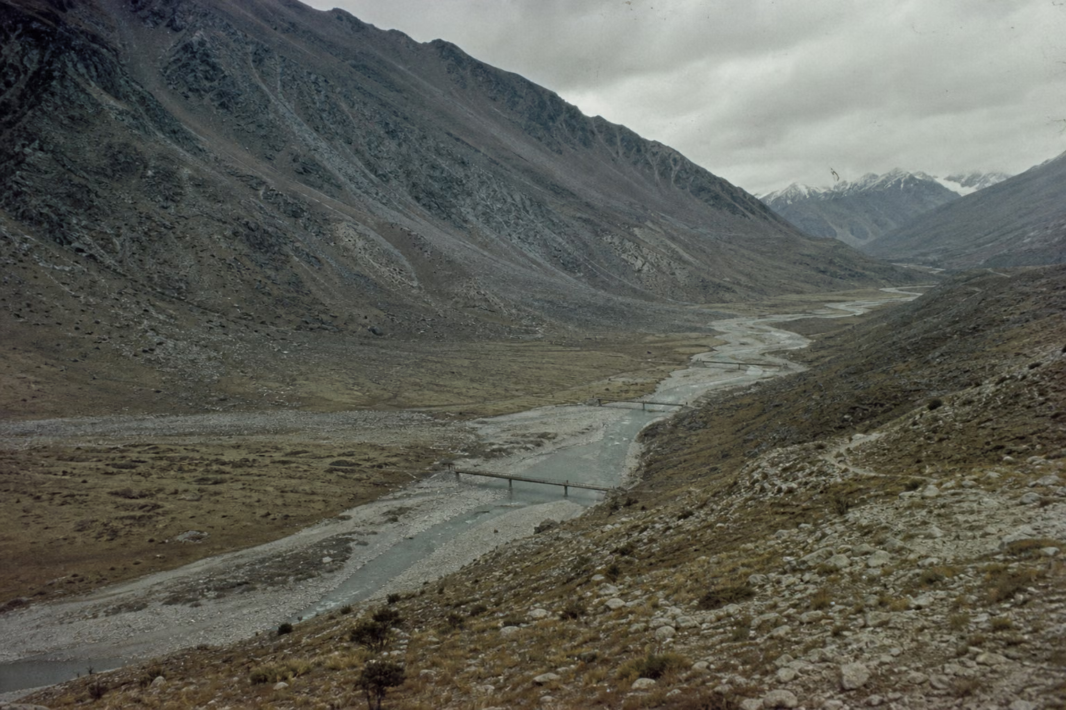
- Elevation and season: the Kejielang River valley and the ridges on both sides stood at about 3,000–4,500 meters above sea level (unverified), and by late October the night temperature was already below freezing. In another month heavy snow would close the passes: both sides were racing winter.
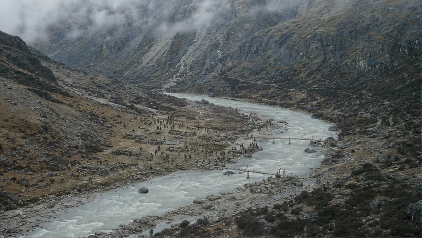
- Terrain: Thag La Ridge on the north bank (controlled by the Chinese side) overlooked the river valley, while behind the Indian positions on the south bank another line of mountains around Hatung La still separated them from their rear. Five bridges over the river, including temporary bridges, were the coordinates for both sides' deployments. From Kejielang to Tawang, the route had to cross Bangshankou and descend along the Tawang river valley (route details unrecorded).
- Tawang: the center of a Monpa-inhabited area, site of Tawang Monastery, and birthplace of Tsangyang Gyatso, the Sixth Dalai Lama; in 1951 Indian troops entered and took over the former Tibetan local government's administration there (time and process unverified).
- On the Chinese side, motor roads reached only toward Cona; beyond that, transport depended on porters and pack animals (unverified).
Why It Was Fought
The decision to counterattack was made in mid-October (see *Sino-Indian War: Overview*), and there was almost no need to choose where the first blow would fall. Along the whole border there were many places where outposts interlocked like teeth, but only at Kejielang had the Indian Army pushed forward not one or two outposts, but an entire brigade. In June, the Dhola Post was established; from September on, the main force of the Seventh Brigade pressed successively onto the south bank of the Kejielang River. On New Delhi's operational map this was called "Operation Leghorn": before winter, it would "clear" Chinese troops from Thag La Ridge. Brigadier Dalvi later wrote in his memoir that his brigade had been pushed to this riverside by orders passed down level by level: ammunition was airdropped on a light scale, winter clothing was not fully issued, and the positions were stretched into a fifteen-kilometer line. New Delhi dared to push this far because it judged that China would at most jostle back a few times and would not launch a counterattack on the scale of a campaign (the Mullik assessment and the Henderson report line remain unverified).
For the Chinese side, Kejielang was the place where the four words "self-defense counterattack" were made concrete: Indian troops had moved first here. On 9.20 the firing began at Zerao Bridge, and the two sides began to take casualties (the two countries' records differ); on 10.10 there was another clash at Cengcong. This was where the deepest crossing of the line occurred, and where the troop concentration was also greatest. If there was to be a fight, it would be here; if it was fought, annihilation was the aim. What Zhang Guohua told Beijing was that they "could win" (the exchange in which Mao Zedong asked whether they could win comes from memoir materials and remains unverified). The forward command committed the three regiments of the Zangzi 419 Unit and attached troops, forming a several-fold advantage over the Seventh Brigade (there was an internal saying about "using an ox-cleaver to kill a chicken," unverified). The plan was for both wings to cross the Kejielang River at night, turn the flanks and rear, and strike directly at brigade headquarters.
The timing was also calculated closely: heavy snow might close the passes at any moment, so the battle had to be finished before the mountains closed. Nehru had already publicly announced the "clear" order on 10.12; if they waited longer, attack and defense would change hands. Around 10.18, the forward command issued the order to launch the counterattack at dawn on the 20th (time of issuance unverified).
In fact, Indian officers themselves had argued against this battle: Dalvi and Prasad, commander of the Fourth Division, had both advocated withdrawing from the river valley and falling back to positions with support, but they were rejected step by step. What New Delhi wanted was not a position that could be held, but the political posture of "no retreat." The Seventh Brigade remained by the river.
Course of the Engagement
| Phase | Time | Key points |
|---|---|---|
| Pre-battle movement | Night of 10.18–19 | Assault troops covertly crossed the river at night and turned the Indian flank and rear; artillery was broken down and carried forward to occupy close positions (unverified) |
| Kejielang general assault | Morning of 10.20–same day | After a dawn artillery raid, infantry attacked (start time unverified), driving straight into brigade headquarters and artillery positions; points including Karon, Qiangdeng, Chedong, and Rongbudiu were taken one by one; the Seventh Brigade's organized structure collapsed that day |
| Clearing and capture | 10.21–22 | Clearing operations on the south bank; Dalvi led remnants in retreat over the mountains and was captured on the way (10.22, date varies by statistical basis and account) |
| Bangshankou direction | 10.20–23 | Supporting troops captured the strongpoints facing them and opened the route toward Tawang (details unrecorded) |
| Entry into Tawang | 10.24–25 | Indian forces abandoned the town and withdrew south toward Xishankou; Chinese troops entered without battle and stopped along the Tawang line |
| Western sector at the same time | 10.20–28 | Xinjiang Military Region troops removed more than thirty Indian strongpoints in the Galwan River valley, at Hongshantou, and along Pangong Lake (figure disputed): the first phase in the western sector is folded into this article in one stroke |
| Political move | 10.24 | The Chinese government statement put forward three proposals: stop the conflict, reopen negotiations, and have both sides withdraw 20 kilometers from the line of actual control; India rejected them, making restoration of the pre-9.8 situation a precondition |
Casualties and Losses
- Indian Army: the Seventh Brigade was destroyed, with about 1,900 killed or captured under Dalvi (Chinese figures, detailed killed-and-captured breakdown unrecorded); the Second Rajput Battalion lost almost the whole battalion (Indian military history: 282 men of the battalion killed, unverified).
- Chinese side: several hundred casualties, with more than one hundred killed (figures vary by account).
- Civilians: the theater was sparsely populated, with no record of civilian casualties (unverified); Tawang's residents and monastery were not touched by the fighting (Chinese records of entry discipline, unverified).
Aftermath
- India was shaken nationwide: on 10.26 it declared a national emergency; Defense Minister Menon left office (sequence unverified); U.S. and British military-aid airlifts began.
- Indian forces contracted to the Xishankou-Bomdila mountain defenses to reorganize; the Fourth Division changed commanders (Pathania replaced Prasad), and reinforcements were pumped from the plains into the mountains.
- The Chinese side stopped along the Tawang line, waiting for New Delhi's reply to the three proposals. What came was preconditions and still larger reinforcements. The board for the second phase was thus laid out (see *Battles of Xishankou and Walong*).
- The brief change of hands of the Sixth Dalai Lama's birthplace later became a footnote in each country's narrative.
Accounts of Those Present
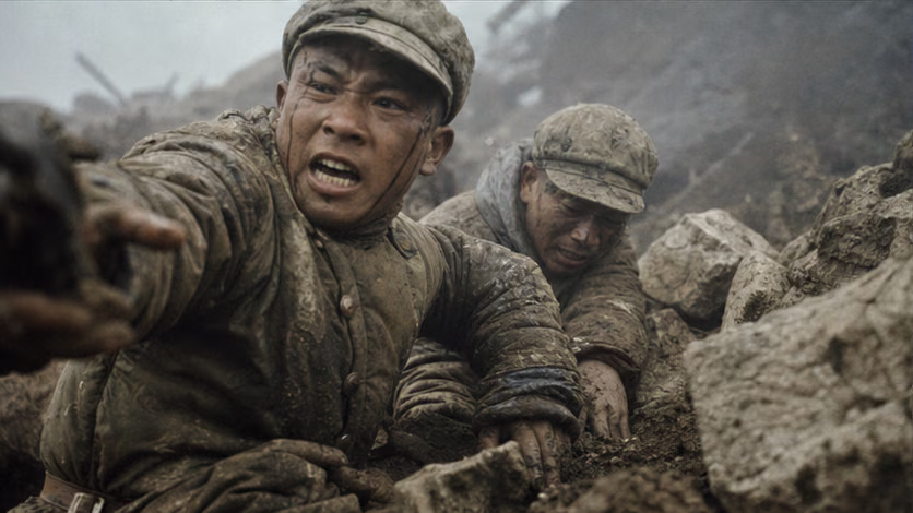
- Yang Ting'an's squad: Sixth Squad, Second Company, 155th Regiment attacked the Karon strongpoint. Squad leader Yang Ting'an led the charge; of the eight men in the squad, seven were killed, and their successors kept advancing. After the battle Zhang Guohua reported to Mao Zedong that the troops were "not afraid of hardship and not afraid of death"; Mao said he approved the slogan, and afterward it entered the vocabulary of the whole army (battle details and the source chain for the wording unverified).
- Dalvi's two days: after brigade headquarters was broken apart, this brigadier walked for two days through mountain woods without supplies before being captured by a search detachment (process unverified). He received officer treatment in the POW camp, was released in May 1963, and later wrote *Himalayan Blunder*: in the book, his anger at the system that sent his brigade into the river valley is greater than his anger at the opponents who captured him.
- Thin uniforms across the line: most Indian soldiers had only single-layer uniforms and blankets, crowding at night into stone fieldworks. Nearly half of the airdropped ammunition and supplies fell into Chinese positions or deep valleys (recorded in Indian military history, unverified): the army was pushed up to the plateau faster than clothing could be put on it.
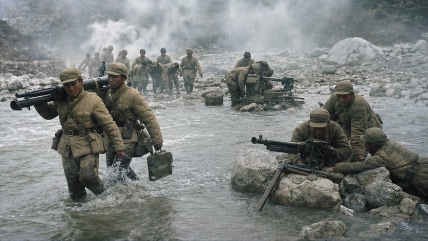
- Guns carried by men: no heavy artillery crossed the mountains. Mountain guns and recoilless guns were broken down and shouldered forward for close-range direct fire; assault troops crossed October's icy river on foot to attack (unverified).
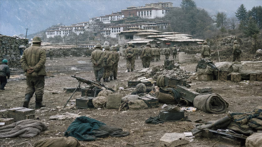
- The empty town and the great monastery: the troops entering Tawang faced hastily abandoned military warehouses and an intact Tawang Monastery; they were ordered to protect the monastery and not enter civilian homes (discipline records unverified).
The Ground
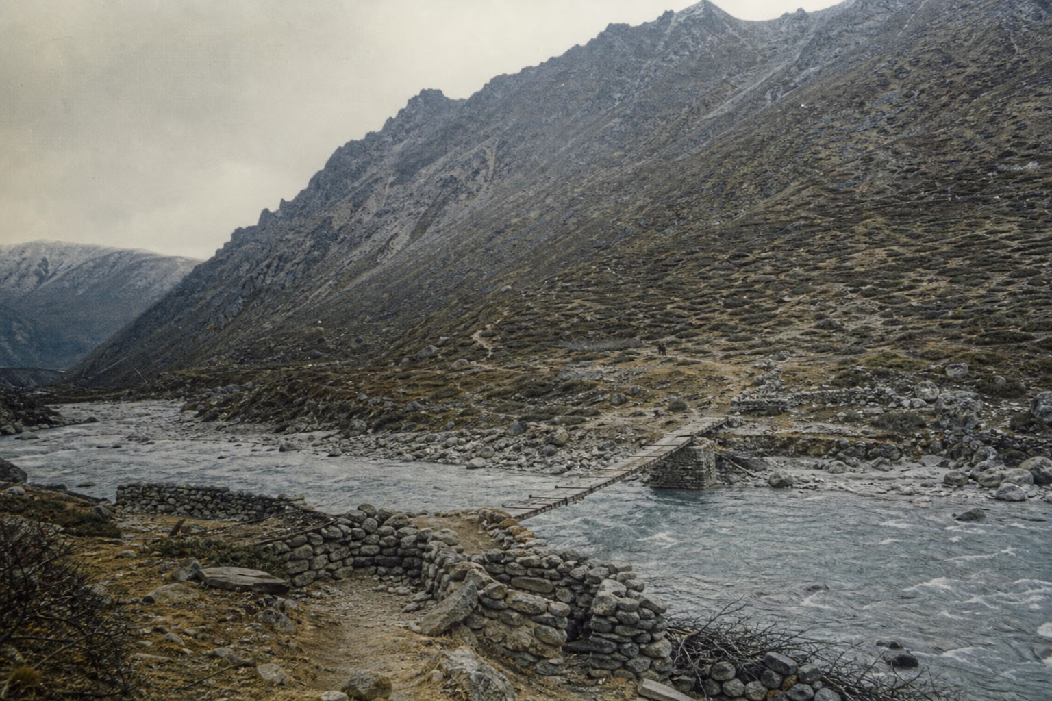
- Inverted elevation: the attacker moved downward from the ridge, while the defender looked upward with water at its back: a battlefield with the elevation relation of ordinary attack and defense reversed.
- "Line" versus "point": a chain of riverside positions across a 15-kilometer front and less than one kilometer in depth; if any point was pierced, the whole line collapsed. The five bridges were the coordinates of deployment and also the bottlenecks of rout.
- A one-day battle at dawn: from the artillery raid to organizational collapse, everything was compressed into one daylight span: short, abrupt, and extremely dense in tempo.
- A silent segment: after Kejielang, the march over Bangshankou and down the Tawang river valley ended at a town with no resistance and a great monastery. It is a rare voiceless passage in the rhythm of the campaign, a blank left in the spatial narrative.
How Each Side Records It
- Indian side: Namka Chu (the Indian name for the Kejielang River) is the first scene of the trauma of "1962" and a core chapter of the Henderson Brooks report, still not declassified. Dalvi's title *Himalayan Blunder* is itself a judgment on this battle. "A brigade pushed into the river valley by politicians" remains the review narrative used within the Indian military.
- Chinese side: written into military history as the first-battle example of the self-defense counterattack; the battle from which "not afraid of hardship, not afraid of death" originated; external narratives emphasize that Indian troops fired first and crossed the line first.
- A rare point of agreement in the two sides' military histories: both hold that the Seventh Brigade's position should not have been defended in the first place. The dispute is only over who bears responsibility.
Disputes and Sensitivities
- Whether the Kejielang River valley and Dhola Post were south of the McMahon Line is read differently on the two countries' maps: the Chinese side says Indian troops crossed the alignment shown on the McMahon Line map, while the Indian side says Thag La Ridge was the watershed alignment intended by that line.
- Each side holds its own account of "who fired the first shot": the two countries' records differ on the 9.20 exchange of fire at Zerao Bridge (unverified).
- Statements about Tawang's historical affiliation are highly sensitive: the birthplace of the Sixth Dalai Lama, the history of the Indian Army's 1951 entry, and subsequent administrative changes are described differently by the two sides.
- There are two sets of enemy-loss figures, including the Chinese figure of more than 1,900 and the various Indian counts; when citing them, mark the source side.
Sources and Open Questions
Sources: *History of the Sino-Indian Border Self-Defense Counterattack* (Military Science Press, 1994); Dalvi's *Himalayan Blunder*; the Kejielang chapters of Maxwell's *India's China War*; participant recollections by Yin Fatang and others (article titles unverified).
Open questions: order of battle and attachment relationships; elevation data for the Kejielang River valley; start time and length of artillery preparation; time when the counterattack order was issued; date and process of Dalvi's capture; detailed enemy losses and Chinese casualties; casualty figure for the Second Rajput Battalion; details of Yang Ting'an's squad and the source chain of the slogan; records from the two countries on the Zerao Bridge exchange of fire; details of the Bangshankou fighting; number of points taken in the western sector; records of the entry into Tawang and discipline protecting the monastery; Indian airdrop loss rate; source of the saying "using an ox-cleaver to kill a chicken"; airdrop point locations; road conditions beyond Cona.
All images on this site are AI-generated depictions. They are not historical photographs, not primary sources, and do not depict any real individual.